
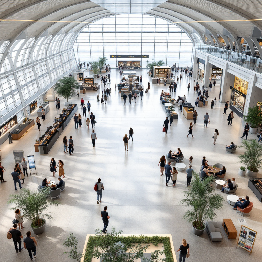
airport, real-time analytics and occupancy overview
Airports use occupancy analytics and heatmap visualization to make terminals more efficient and safer. First, heatmap tools show where people gather, while occupancy metrics provide precise occupancy levels for specific zones. Next, operators can map traffic flow and layout to identify high-traffic areas, and then act to reduce queues and balance services. Also, these systems collect real-time data from multiple sources so staff can make informed decisions quickly. For example, combining people counting sensors, Wi-Fi logs, and CCTV streams produces real-time insights that help airports adjust check-in and security lanes.
Real-time data arrives from ceiling-mounted people counters, camera-based sensor feeds, and Wi-Fi probe logs. Then, analytics platforms fuse those feeds into dashboards that display occupancy data and dwell patterns throughout the terminal. Additionally, integrating camera feeds with a tailored analytics solution lets teams count people accurately, and detect crowding in restricted areas. Visionplatform.ai turns existing CCTV into a working sensor network, so operators can leverage precise data without adding extra hardware or losing control of their data. That approach supports GDPR and EU AI Act readiness and keeps analytics local.
Heatmap tools reveal where passengers cluster and how visitor flow changes hour by hour. Consequently, planners can redesign layout, add temporary seating, or reroute flows to reduce dwell-time and reduce wait times. According to retail studies, airport shopping traffic grows around 10.4% year-over-year, so airports that optimize space and retail placement gain measurable revenue. Furthermore, benchmarking across locations yields valuable insights for tenant mix, as noted by industry vendors who show how data can identify high-performing retail zones (V-Count).
Finally, heatmaps and mapping tools let teams visualize boarding gates, baggage claim, and corridors. Therefore, they see where foot traffic peaks and where bottleneck risk exists. Also, data analytics validates predictive models with empirical data so forecasts remain reliable (NASA study). In short, this chapter outlines how an airport can count people, map movement, and use data visualization to streamline operations and improve passenger experience now.

optimize space utilization to help airports achieve operational efficiency
To optimize space utilization, teams combine heatmap analytics with scheduling and staffing rules. First, analytics show where dwell concentrates and which zones suffer from persistent congestion. Then, operators reassign gates, open temporary security lanes, or shift retail staffing to match demand. Also, adjusting layout and seating reduces dwell-time and improves passenger satisfaction. An analytics platform can present a dashboard with occupancy levels for each gate, so managers can adjust operations before crowds form. This data-driven approach helps airports optimize the use of floorspace, retail areas, and waiting lounges.
Dynamic allocation of boarding gates and security lanes reduces bottleneck risk and shortens queues. For instance, a major international airport used predictive occupancy maps to rebalance gate assignments and saw measurable reductions in wait times and transfer delays. Moreover, operators used an analytics solution to redesign passenger routing around peak windows, which cut dwell-time near check-in by up to 15% in trial runs. These performance gains demonstrate how optimizing space cuts operational costs and elevates passenger satisfaction, while improving operational efficiency for ground and airside teams.
Retail and concessions benefit too. By mapping traffic patterns and sales data to heatmaps, airports can place high-demand kiosks in high-traffic zones. In addition, benchmarking across terminals shows which concessions underperform, and guides resource allocation for marketing and staffing. To help airports act faster, Visionplatform.ai streams camera events to operations dashboards via MQTT, so staff get alerts when foot traffic spikes. As a result, cleaning crews and retail staff arrive where needed, and managers can make data-driven decisions in minutes rather than hours.
Finally, planners can use a mapping tool to simulate layout changes before investing in construction. Consequently, they preserve space efficiency while improving flow. Also, flexible options like pop-up retail and modular seating let airports respond to seasonal spikes. Thus, optimising both architecture and operations keeps terminals agile and passenger-centric.
AI vision within minutes?
With our no-code platform you can just focus on your data, we’ll do the rest
data-driven resource allocation, people counting and queue management with alert systems
Data-driven allocation ensures the right staff are in the right place at the right time. First, people counters and camera-based sensors feed an analytics platform with precise data points. Then, managers use dashboards to monitor queue lengths, dwell at security, and staffing gaps. Also, triggers in the system generate an alert when occupancy levels exceed safe thresholds, or when a queue grows too long. These real-time alerts allow supervisors to deploy staff immediately, so lines move faster and operational efficiency improves.
People counting technologies include infrared counters, overhead camera analytics, and Wi-Fi probe analysis. Each method counts people with varying accuracy, and when fused they provide robust occupancy data. For detailed implementations, see solutions for people counting in airports. Additionally, Visionplatform.ai integrates with existing VMS and streams detections so teams can react without sending video off-site. That local processing reduces privacy risk and ensures precise data for resource allocation decisions.
Queue management ties into staffing, cleaning, and retail scheduling. For example, cleaning teams receive alerts to clean a restroom or lounge after a peak, while security gets notified when a lane needs another officer. Also, retail managers see when to add tills or open a pop-up checkout. People counters feed the queue management engine and measure dwell, so the system can suggest opening or closing lanes. Consequently, the airport reduces wait times, balances load across lanes, and reduces stress for travellers.
Finally, algorithms can predict short-term demand and suggest where to post temporary staff. Such predictions come from advanced analytics that analyse past peaks and current arrivals. In a fast-moving environment, these tools help staff act fast and measure the impact of changes to schedules. If you want to explore crowd density use cases, check our work on crowd detection and density in airports.
visitor flow, wayfinding and passenger experience enhancements
Mapping visitor flow reveals how passengers move from curb to gate. First, heatmaps show common paths and where people pause. Then, planners use that information to place wayfinding screens and signs where they will reduce confusion. Also, dynamic wayfinding can guide passengers to underused corridors, which helps identify high-traffic zones and reduces pressure on popular routes. As a result, transfer times fall and the travel experience improves.
Digital wayfinding screens that react to occupancy data make a noticeable difference. For example, dynamic screens can redirect arriving passengers to less congested security lanes, which reduces queue lengths. In addition, integrating wayfinding with live dashboards gives ground staff the ability to direct foot traffic during peaks. For technical approaches to people detection and thermal sensing, see related solutions like people detection in airports and thermal people detection in airports.
Passenger experience improves when travel flows feel predictable and fast. Also, simple changes like clearer signage, better seating layout, and improved mapping of amenities reduce dwell-time and frustration. Surveys show that targeted wayfinding upgrades increase passenger satisfaction scores and speed up transfers between gates. Therefore, airports can measure the impact of these changes using dashboards that report on dwell-time, foot traffic, and passenger satisfaction. Alongside operational benefits, wayfinding solutions also reduce operational costs by cutting staff time spent on ad-hoc directions.
Finally, location-based insights help airports personalise messages to passengers. For example, a passenger waiting near retail can see promotions on nearby stores. Likewise, dynamic guidance can steer families to quieter play zones. Consequently, airports streamline passenger journeys and increase retail conversion without creating extra crowding. This approach balances commercial goals with the core mission of safe, efficient movement throughout the terminal.

AI vision within minutes?
With our no-code platform you can just focus on your data, we’ll do the rest
advanced analytics for asset tracking and airport baggage handling with real-time alerts
Advanced analytics improve baggage handling and asset tracking by forecasting flows and detecting bottleneck behaviour. First, analytics models predict how many bags will arrive per flight and which belts will fill fastest. Then, managers use those forecasts to staff baggage claim and to pre-position trolleys and carts. Also, asset tracking using RFID and camera-based detection reduces time spent locating ground-service equipment. As a result, teams recover assets faster and reduce delays at belts.
Airport baggage systems benefit from heatmap analytics that overlay baggage claim activity with belt utilisation. This kind of mapping makes it easy to spot a persistent bottleneck at a conveyor. In turn, operations teams receive a real-time alert when a belt exceeds threshold utilisation, so they can reroute loads or call for maintenance. For airport baggage handling, a combination of RFID tags and camera events cuts the time to find misplaced luggage and reduces lost-luggage incidents.
Asset tracking also covers trolleys, carts, and ground vehicles. A reliable analytics platform will merge ANPR/LPR, object detection, and location-based insights to report where assets sit. Visionplatform.ai supports ANPR/LPR integration and streams structured events to operations systems, so that asset managers get continuous updates. Additionally, these systems help plan preventive maintenance by analysing usage patterns and identifying wear trends.
Finally, advanced analytics help measure the impact of process changes. Teams can compare pre- and post-intervention data points to see how an alerting rule reduced average recovery time for a cart, or how a belt reassignment lowered dwell-time at baggage claim. Consequently, airports achieve better throughput, fewer passenger complaints, and lower operational costs through predictable, data-backed adjustments.
terminal space, travel experience and space efficiency: future insights
Looking ahead, airports will use predictive occupancy maps to design flexible terminal space. First, planners will convert underused zones into modular seating or pop-up retail based on forecasts. Then, operations will deploy staff, gates, and security dynamically to match demand. Also, integrating AI-driven platforms will unify security, passenger flow, and airside safety into one view. As Softlabs Group describes it, “The ultimate vision is to create a unified platform that integrates data from security, passenger flow, airside safety, and general operations” (Softlabs Group).
Innovations like modular furniture, pop-up retail, and flexible boarding gates improve space efficiency and passenger comfort. Moreover, airports can experiment with alternate layouts virtually before committing to construction. Also, Internet of Things devices combined with camera sensors provide precise data on occupancy and layout usage throughout the terminal. That precise data supports decisions about where to place charging stations, how to size seating clusters, and where to add services to reduce bottleneck risk.
AI and advanced analytics will allow teams to make data-driven choices in seconds. For instance, systems can predict a sudden peak at boarding gates and recommend opening an extra lane. Additionally, the same systems provide dashboards that help measure the impact of interventions on passenger satisfaction and operational efficiency. Finally, by keeping models and data on-premise, organisations can control risk and comply with regulation while still gaining real-time insights and the ability to make data-driven decisions.
To summarise, airports that leverage heat maps, mapping tools, and analytics even in small pilots will gain agility, improved safety protocols, and a better travel experience. Also, they will be better placed to identify high-traffic areas and to streamline operations in the face of growing passenger volumes. Ultimately, such systems provide valuable insights that help airports plan and adapt in a fast-changing world.
FAQ
What is an airport occupancy analytics heatmap?
An airport occupancy analytics heatmap is a visual tool that shows where people cluster in a terminal. It overlays occupancy data on a floorplan to highlight high-traffic zones and potential bottleneck locations.
How do sensors and cameras count people?
People counting uses a mix of sensor types, including ceiling-mounted people counters, camera analytics, and Wi-Fi probe logs. These inputs combine to produce precise data points for dashboards and operational alerts.
Can heatmaps really reduce wait times?
Yes. Heatmaps reveal crowding patterns so staff can activate extra lanes or redirect passengers. By acting on those signals, airports reduce wait times and improve passenger satisfaction.
Are predictive occupancy maps accurate?
Predictive maps become accurate when validated against empirical observations and separate datasets. Research shows models perform well when they use historical data and real-time inputs for forecasting (published study).
How do alert systems work for queue management?
Alert systems monitor occupancy levels and queue lengths. When thresholds trigger, they notify staff so teams can deploy additional resources and streamline operations immediately.
What role does asset tracking play in baggage handling?
Asset tracking locates trolleys, carts, and ground equipment, and helps forecast belt utilisation. This reduces lost equipment time and minimizes bottlenecks at baggage claim.
Can my existing CCTV be used as sensors?
Yes. Platforms like Visionplatform.ai convert existing CCTV into operational sensors that detect people and objects in real time. This approach saves cost and keeps data on-premise for compliance.
How do wayfinding upgrades improve passenger experience?
Dynamic wayfinding reroutes passengers to less crowded areas and clarifies paths to gates. These changes lower transfer times and improve the overall travel experience.
Is RFID necessary for airport baggage tracking?
RFID adds visibility for individual bags and complements camera-based detection. When combined with analytics, it delivers faster recovery and fewer lost-luggage incidents.
How can airports measure the impact of these changes?
Airports use dashboards to track KPIs like dwell-time, wait times, passenger satisfaction, and operational costs. These metrics show whether layout or staffing changes reduced bottlenecks and improved flow.